Glenwood Canyon
Scenic canyon on the Upper Colorado River in western Colorado.

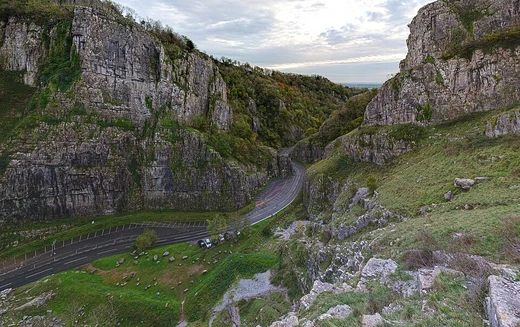
Glenwood Canyon is a rugged scenic 12.5-mile (20 km) canyon in western Colorado, United States, with walls climbing as high as 1,300 feet (400 m) above the Colorado River. It is the largest such canyon on the Upper Colorado and has historically provided routes for railroads and highways through western Colorado.
- length
- 12.5 miles (20 km)
- maximum wall height
- 1,300 feet (400 m)
- location
- Western Colorado, primarily Garfield County, with upper portion in Eagle County
- geologic formation
- Cut through sedimentary rock in Pleistocene time; upper layers of Pennsylvanian
- major routes
- Interstate 70 and Union Pacific's Central Corridor
- notable feature
- Hanging Lake Tunnel and four rest areas along I-70
Lore & Background
The canyon was formed relatively recently in Pleistocene time by the rapid cutting of the Colorado River down through layers of sedimentary rock. The upper layers are sandstone from Pennsylvanian and Mississippian periods, while sections of the lower canyon walls are made of Cambrian rock.
Reader's Guide
Glenwood Canyon is significant as the largest canyon on the Upper Colorado River and as a historic transportation corridor through western Colorado.
Did You Know?
- Glenwood Canyon is the largest canyon on the Upper Colorado River.
- The canyon carries both Interstate 70 and the Union Pacific's Central Corridor (formerly the Denver and Rio Grande Western Railroad).
- A monument to the California Zephyr's dome car design was originally installed in the canyon but was relocated to the Colorado Railroad Museum in Golden in the 1990s.
Geological Birth of a Canyon
A canyon is, at its core, a story written in stone over millions of years. Rivers possess an almost relentless drive to cut downward through whatever rock lies beneath them, carrying sediments away and gradually carving deeper channels. When a river's source sits at a dramatically different elevation than its mouth, and when the landscape presents a patchwork of soft and hard rock layers, the result is the kind of deep, steep-walled cleft we recognize as a canyon. In drier climates, this process accelerates because physical weathering strikes with more localized force, and wind works alongside water to strip away less resistant materials like shale. Frost wedging adds another dimension: water seeps into fractures, freezes, expands, and pries apart chunks of rock until entire sections of a canyon wall crumble away. The walls that remain are typically composed of tougher materials—sandstone or granite—that resist the elements. In some regions, tectonic uplift raises the land beneath a river, which then becomes entrenched, unable to reroute, and simply cuts deeper into the rising terrain.
A Word Carved by Geography
The very word we use to name these landforms carries a geographic fingerprint. 'Canyon' traces its roots to the Spanish cañón, a term that traveled northward and became the standard descriptor across much of North America. In Europe and Oceania, the French-derived words gorge and ravine tend to dominate instead. Even within the United States, a subtle linguistic divide exists: place names in the southwest, closer to Spanish-speaking Mexico, favor 'canyon,' while those in the northeast, nearer French Canada, lean toward 'gorge.' The middle of the country blends between the two. Canada draws its own distinction—a gorge is typically narrow, whereas a ravine is broader and often wooded. South Africa layers yet another term, kloof, alongside canyon and gorge. The British military lexicon occasionally contributes the word defile. So the name a community gives its deepest cleft quietly reveals centuries of linguistic and cultural exchange.
Shapes and Classifications
Not all canyons share the same silhouette. A box canyon, for instance, is a shorter, narrower cleft with steep walls closing in on three sides, leaving only a single mouth for entry and exit. In the western United States, settlers and ranchers recognized the practical value of this geometry, fencing the narrow entrance and using the enclosed space as a natural corral. Slot canyons present a different extreme: passages so narrow that their walls appear almost smooth, creating a corridor-like experience. When a cleft splits the space between two mountain peaks—whether in the Rockies, the Alps, the Himalayas, or the Andes—it is typically a river or stream that has forced its way through. Submarine canyons, found on the continental slope beneath the ocean, owe their formation to an entirely different mechanism: turbidity currents and underwater landslides rather than the slow grinding of a surface river. Each type tells a distinct story about the forces that shaped it.
Scale, Wonder, and Human Presence
Debates over which canyon on Earth is the largest or deepest reveal how imprecise such superlatives can be. A canyon might claim the title by depth, by length, or by the sheer volume of its system, and inaccessibility in places like the Himalayas keeps some candidates out of the conversation entirely. The Yarlung Tsangpo Grand Canyon in Tibet, the Kali Gandaki Gorge in Nepal, and the Cotahuasi and Colca canyons in Peru all press claims to extraordinary depth, while the Grand Canyon in Arizona, averaging around 1,600 metres deep, was a finalist in the New 7 Wonders of Nature poll. Australia's Capertee Valley, though shallower, actually exceeds the Grand Canyon in width. Beyond measurement, canyons hold profound cultural weight: Africa's Olduvai Gorge has yielded evidence of archaic humans, and the southwestern United States preserves cliff dwellings built by ancient Pueblo peoples, reminding us that these dramatic landscapes have always been home to human story.
More in Caves & Gorges 1-23
Related in Caves & Gorges
Links follow this subject's own source article.
Spotted an error? Know more?
This is a living reference — every entry is fact-audited, and reader corrections feed straight into our audit queue. Suggest an edit · See this site's audit record